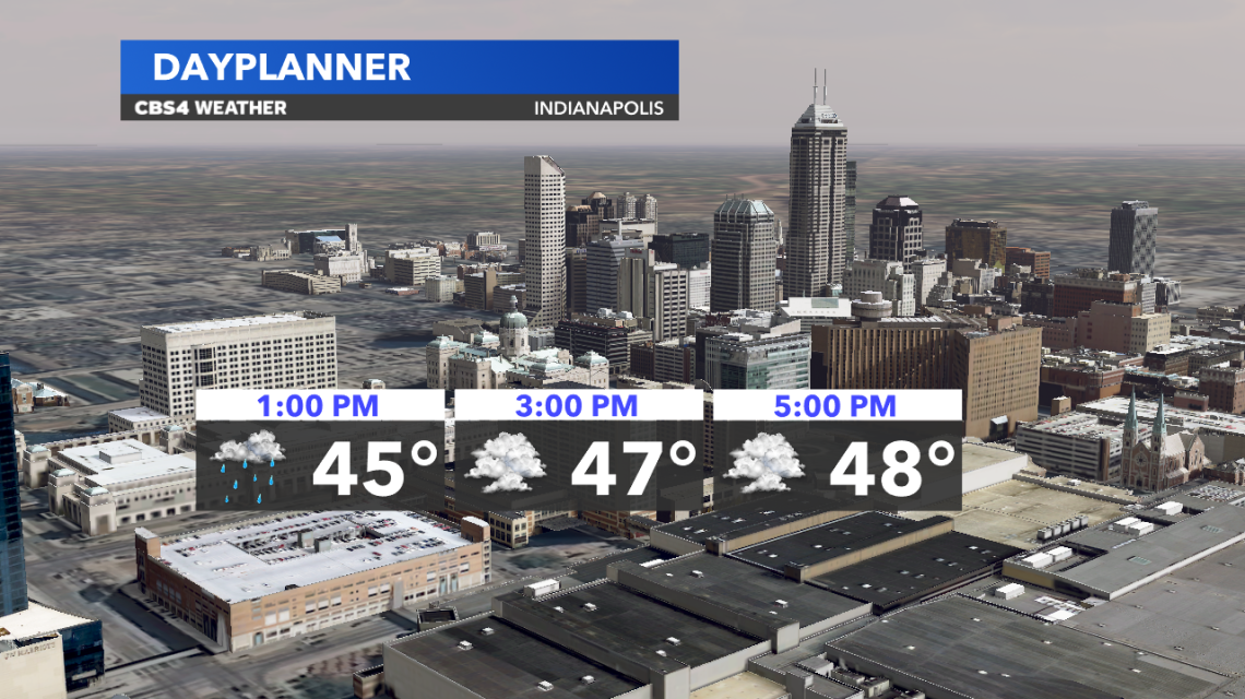
Friday will be cloudy and cold with high temperatures that will be running ~10° below average for the time of year. Expect central Indiana to peak in the upper 40s this afternoon. The closed low that kept rain chance around the past couple days is pulling away and taking the rain chances with it. A few patchy showers are expected at times today, however, there will be a lot of dry time today.
A Freeze Warning has been issued for central Indiana and will be in effect from 2 AM to 10 AM Saturday. Temperatures will drop to the upper 20s and lower 30s. If you have sensitive plants blooming, it is recommended to cover them or bring them indoors, if you can.

We will also see some patchy fog to begin our Saturday with clear skies in place. Abundant sunshine prevails throughout Saturday with temperatures that will climb to the mid 50s in the afternoon.

For the past few weeks we’ve been eyeing a system that will swing through ahead of the eclipse. There is still some uncertainty in the forecast but the picture is becoming more clear as trends sway in our favor. We will see rain move in Sunday afternoon and evening. The timing of this system’s departure has sped up slightly. This is great news for central Indiana. We are favoring rain exiting by very early Monday morning and clouds breaking as we head into the afternoon. At this time, we are looking at a good possibility for brighter skies at the eclipse totality with high thin clouds still in the area. Again, there are still changes that could be seen between now and then, so, continue to check back for updates.